
The Milford Track
For the last few years my daughter Sarah, her fiance Sach and myself have been completing a great walk every summer. This year Sach managed to get a us a booking on the Milford track which was pretty exciting. I had thought about walking the Milford track years ago but gave up on the idea when I realized how booked up it was so I was really thrilled when Sach managed to get a booking for us in early February.
We set off Te Anau on the 1st Feb with the weather outlook looking pretty gloomy for our 4 days on the track. We woke on the Friday morning to heavy rain and cloud low down over the hills and over the lake. We set off on the short walk from our hotel to the visitors center in solid rain with all our wet weather gear on however by the time the bus turned up to take us to Te Anau downs the rain had stopped and when we got to Te Anau downs, patches of blue sky started to appear.
We got some great views of the mountains over the lake as we headed to the start of the track at Glade Wharf

Looking North up Lake Te Anau from the boat.
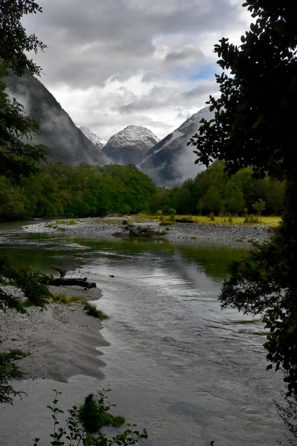
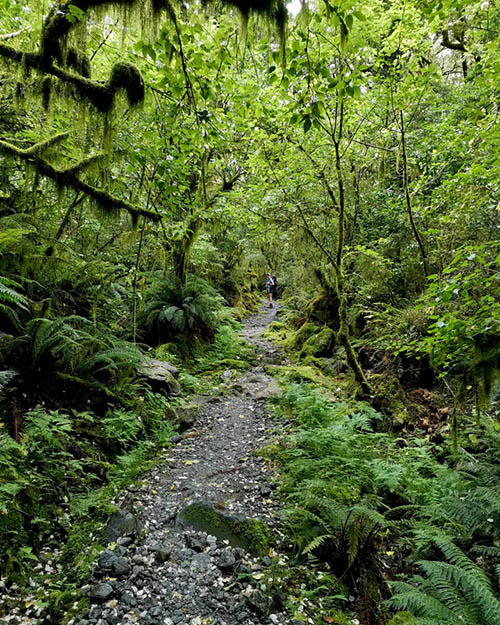
Unfortunately, by the time we got to Glade Wharf it was raining again, so we set off on the start of the track in light rain. The first day is on ly a short walk on an easy track through beautiful beach forest.After about 15 minutes you past Glade House (One of the Ultimate Hikes lodges) and then cross the Clinton river via a long swing bridge. The track then follows the river bank. Shortly after we crossed the river, the rain stopped and the cloud started to break up giving us some great vies out over the river and surrounding hills.

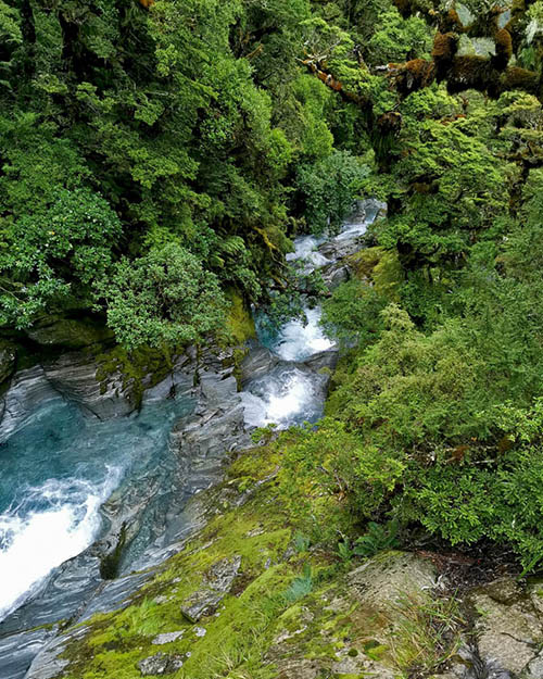
A bend in the Clinton River
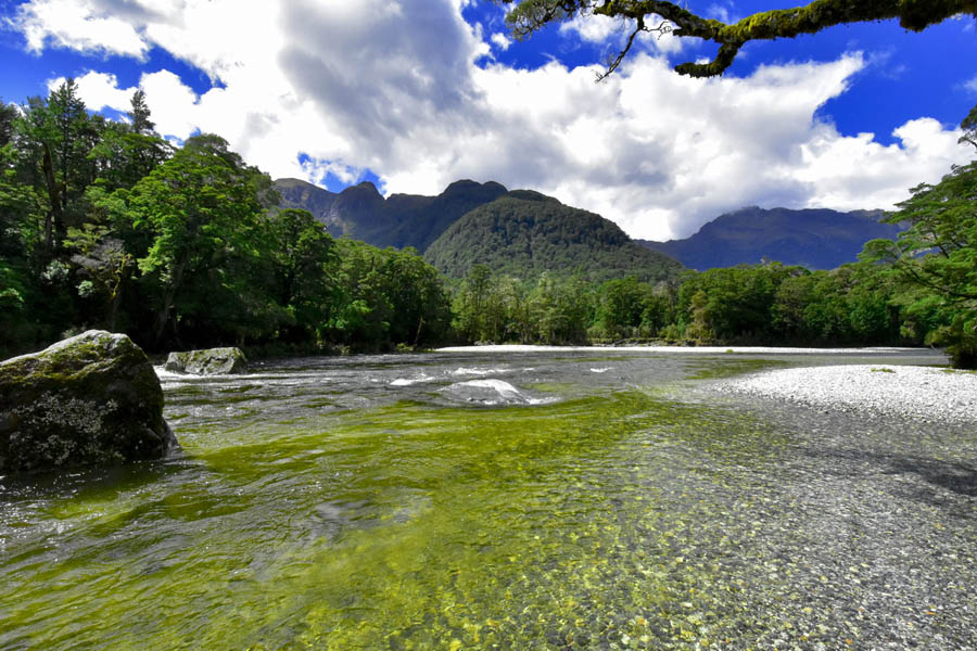 Another view over the Clinton River
After a bit more than an hours walking we reached Clinton Hut where we claimed our bunks for the night and had some lunch.
A friendly robin (toutouwhai) came and checked out Sachs boots while we were having lunch.
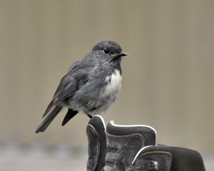 Robin perched on Sachs boot.
We had a relaxed afternoon at Clinton Hut, reading and playing cards and preparing a freeze dry feast for dinner.
Just after we got back to the bunk rooms, it started to rain with the rain setting in for the night.
I woke around 6:00am to the sound of heavy rain falling on the roof and dozed for another hour before making the effort to get up. Miraculously, just as we were getting up the rain stopped and the clouds parted to reveal new snow on the high peaks.
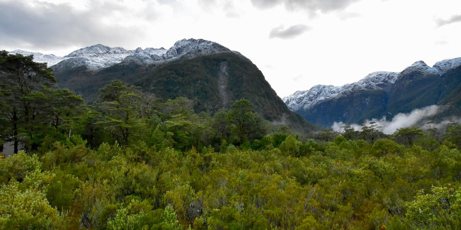 The morning view from Clinton Hut.
The morning lethargy suddenly turned to enthusiasm as the weather cleared with everyone being pretty excited about the day ahead as we rushed to have breakfast, sort our packs out and get on the track for day 2.
Day 2 involves a 17K hike up the Clinton valley to Mintaro hut which is nestled in the head of the valley below McKinnon pass. With the weather for the next two days forecast to turn to rain again we were intending to get to Mintaro hut for lunch and then head up to McKinnon pass in the afternoon to get the views while the weather held.
From Clinton hut the track has a gentle gradient and we made good time as we headed up the valley stopping multiple times to take photos.
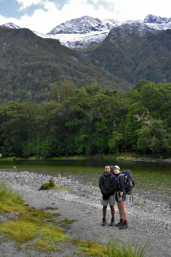
Sarah and Sach with the Clinton River behind them.
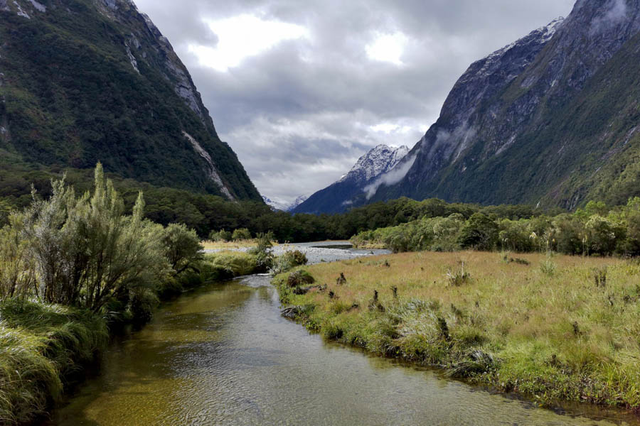
Looking Up The Clinton River The Snow Clad Peaks.
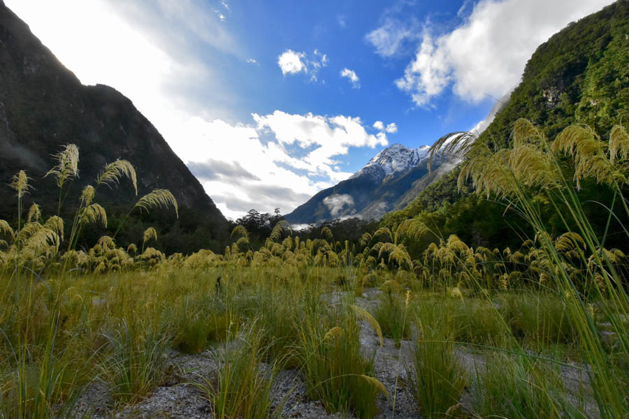
Looking Down the Clinton Valley over some Toi Toi
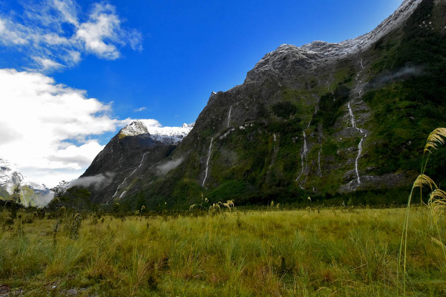
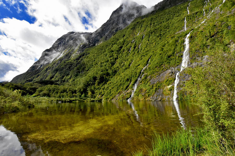
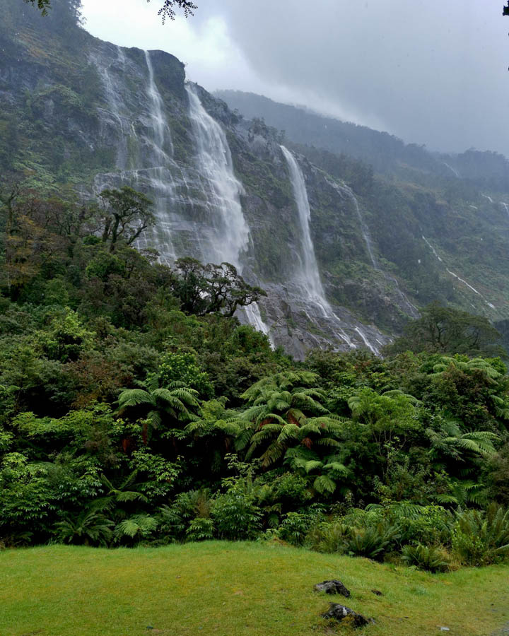
Cliffs Teaming With Waterfalls above the Clinton Valley.
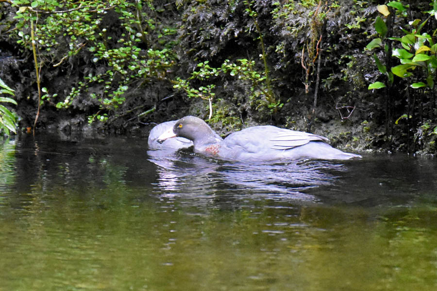
A pair of whio (blue duck) in the Clinton River.
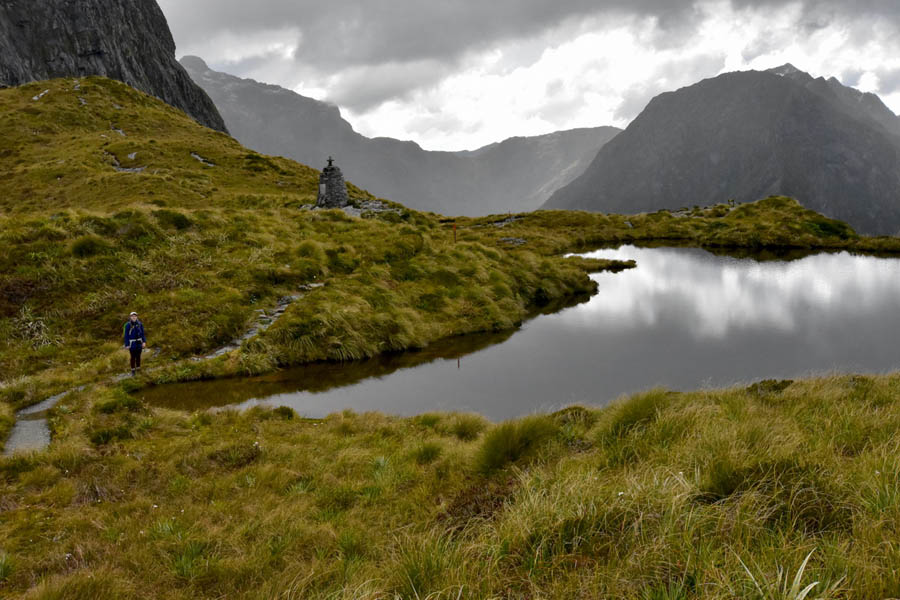
After around two hours we arrived at Hidden Lake where we had a quick snack. Some of the other trampers had plunged in for a bracing swim though they didn't stay in long.
Hidden Lake
 View up the Clinton Valley towards McKinnon Pass from near Hidden Lake.
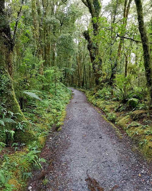
The track carries on along the river flats past Prairie shelter and then starts to climb a bit more as you pass the Bus Shelter and then Pampola Lodge. After Pampolona lodge the track starts to climb into the head of the valley through some lovely bush and patches of ribbon wood which were in blossom.
A section of the track with Sarah in the distance.
About 20 minutes below Mintaro hut, we passed the the helipad where you can get views of Lake Mintaro and the valley
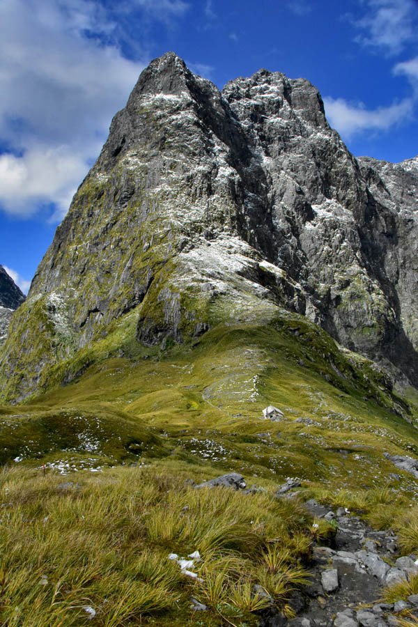
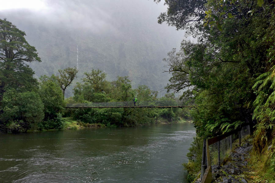
After the helipad there are a couple of swing bridges across the Clinton river before you arrive at the new Mintaro Hut. The new hut was completed in 2021 after DOC identified that the old hut was located in a potential rock fall path. It s a pretty flash hut and even provides USB chargers.
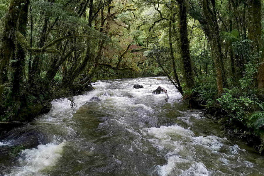
Clinton River from the swing bridge below Mintaro Hut
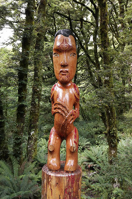
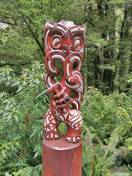
On the path to the hut you are greeted by three pou whenua (Maori pole carvings) which are linked to the creation legend for Milford Sound and the McKinnon pass.
The first pou is Tu Teraki Whanoa who was a demigod that shaped the land of fiordland. He carved out the fiords with his toki (adze). His culminating work was Milford Sound which he created as a place of great beauty.
The 2nd pou is the goddess Hinenui te Po. When she saw how beautiful Milford Sound was she realised that people would come and stay and do nothing but enjoy the beauty so she created sand flies to ensure the people would not stay long.
The 3rd pou is Te Ruru, a junior demi god who came to put the finishing touches on the land after Tu Teraki Whanoa had been called away.
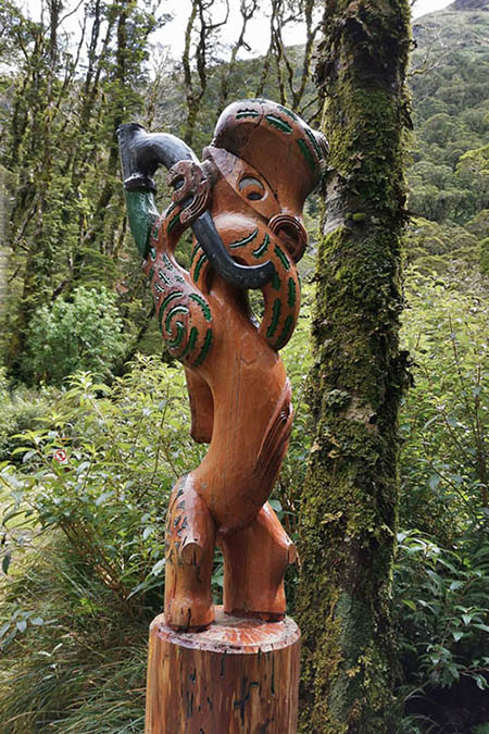
Tu Teraki Whanoa
Hinenui te Po
Te Ruru
We arrived at Mintaro hut around 1:00pm after approx 5 hrs walking from Clinton hut and after claiming our bunks , stopped for lunch before getting ready to head up to the McKinnon pass.
As we were having lunch the weather started to close in and by the time we were ready to set off it had started raining. This was consistent wit the forecast which also said that it was supposed to clear up again later in the afternoon so we decided to take out chances, donning our rain coats and heading off into the rain.
As we approached the pass, the sun broke through and suddenly a huge rainbow appeared down in the Clinton valley. I don’t think I’ve ever looked down on a rainbow from above like this before, it was pretty cool.
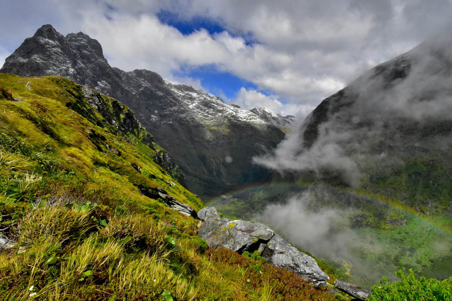
Looking Down On the Rainbow Across the Top Of The Clinton Valley.
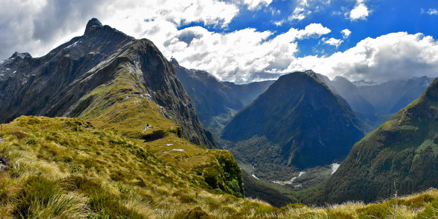
Then suddenly we were up on the pass with great views of the peaks and down over the valleys. The cameras came out and tons of photos got taken. It had taken us about 90 minutes to get up onto the pass from the hut
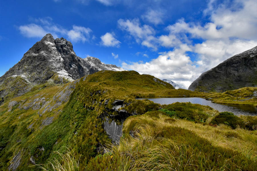
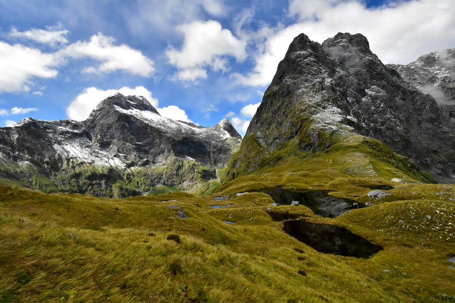
McKinnon Pass with Mt Balloon behind.
Mt Elliott and Mt Wilmur.
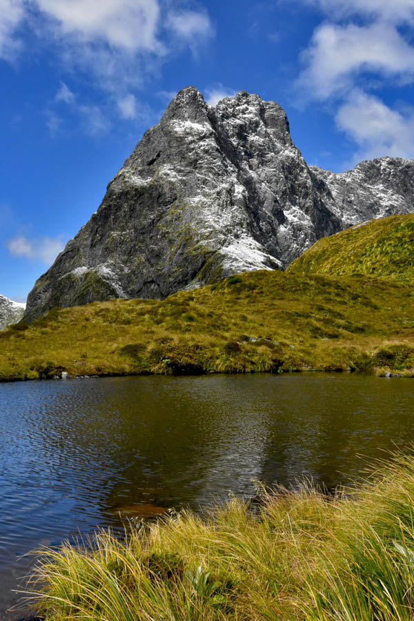
Mt Balloon rising impressively above the tarn.
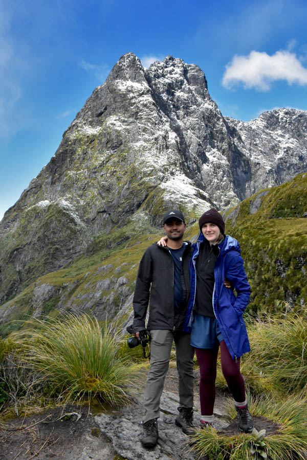
Sarah & Sach at McKinnon Pass
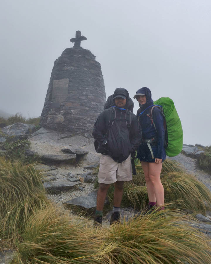
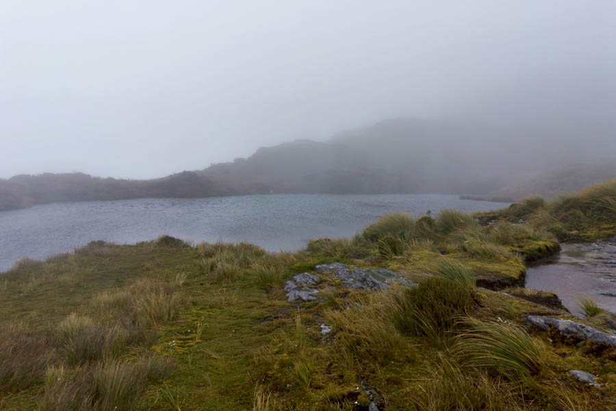
The track gains the pass by the monument to Quinton McKinnon where there is a large tarn (which is where all the above photos were taken). The track then turns north along the pass climbing higher before descending to the McKinnon shelter at the other end of the pass. From there the track descends into the opposite valley which is where we would be going the next day.
After we’d exhausted the photographic possibilities by the monument we headed on up the pass with more great views being revealed every few minutes and my camera being put to constant use.
Sarah standing adjacent to the tarn with the monument to Quinton McKinnon behind.
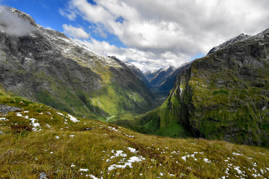
Looking back towards the monument and down into the top of the Arthur Valley from near the top of the pass.
Sarah near the top of the pass with the Clinton Valley in the background.
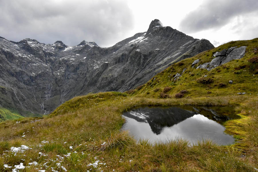
Looking down over the McKinnon Shelter with Mt Balloon behind.
Mt Elliott.
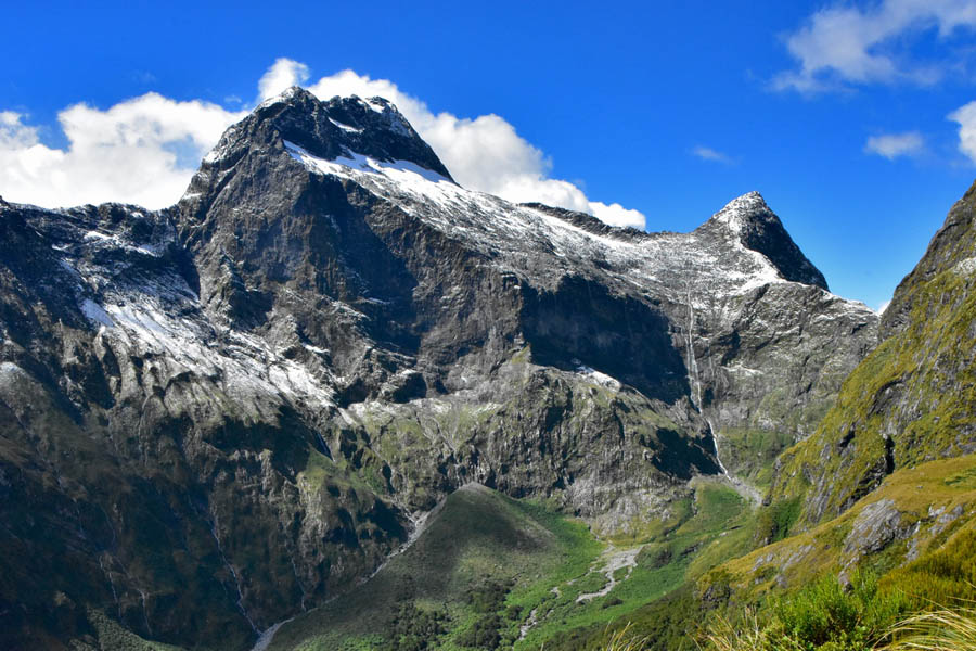
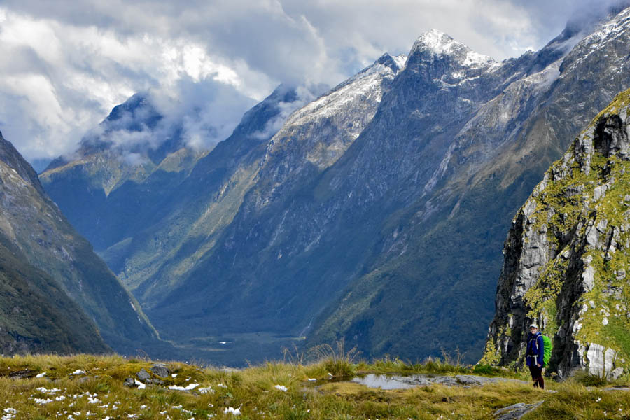
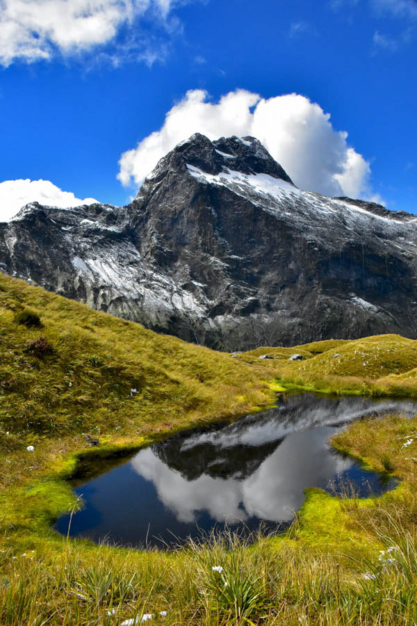
Clinton Valley – note the patches of snow in the foreground.
The mountains at the head of the Clinton Valley.
Left To Right, Mt Elliott, Mt Wilmur, Mt Balloon.
When we finally got bored with taking photos we headed back down off the pass getting back to the hut just before 6:00pm in time to cook up another freeze dry treat for dinner.With the excursion up onto the pass we had been tramping for 9 hrs covering 30km, but well worth it especially when we woke and saw what the weather was like the next morning.
I was pretty tired and slept well that night but it had been a fantastic day.
Day 3
Day 3 is 13km hike up over the pass (retracing our steps from the previous afternoon) descending into the Arthur Valley to the Dumpling Hut. There is an approx. 40 min detour to see Sutherland falls when you get down to the valley floor.
We woke to see cloud settling thickly over the peaks and by the time we had had breakfast the rain had started so it was on with the rain coats and out into the weather. We made good time heading up onto the pass with the rain getting heavier as we climbed. When we reached the pass we were confronted with gale force winds and near horizontal rain. A bit of a difference from the previous afternoon.
Sarah and Sach enjoying the refreshing change in the weather at the monument.
The views from the tarn, a bit different than we saw on the previous afternoon.
It wasn’t very pleasant as we headed along the pass to McKinnon shelter and we were pretty grateful when we finally reached the shelter and scrambled inside out of the wind. We stopped for a quick snack and headed back out into the wind wanting to get off the pass before it got any worse. As we left the shelter, Sarah nearly lost her pack cover in the wind but Sach managed to grab it and tie it on securely as we made away down the other side of the pass. I had hoped we would be out of the wind as soon as we dropped over the side of the pass but we were pretty exposed most of the way down wit the wind nearly knocking us off our feet a couple of times.
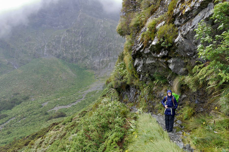
Sarah on the descent down off the McKinnon Pass.
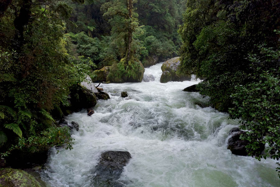
We finally gained the valley floor and entered the relative shelter of the bush. Soon after entering the bush, the track descends steeply on wooden steps adjacent to the roaring torrent of the Andersons cascade. It was pretty spectacular with the river swollen by the rain.
Sarah & Sach at the Anderson Cascade.
Looking down on the roaring torrent.
At the bottom of the cascade there is a small open shelter and a toilet then after that the track carries on descending through some beautiful beech forest until you reach the turnoff to Quinten lodge (The 3rd Ultimate Hikes lodge) and the track to Sutherland falls. There is also a much welcomed fully enclosed shelter for the independent hikers with a hot water boiler. A great spot to stop for lunch on a wet day and somewhere safe to leave your pack out of the rain while taking the detour to Sutherland falls.
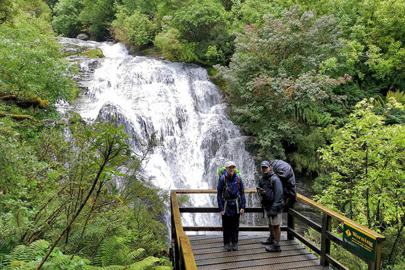
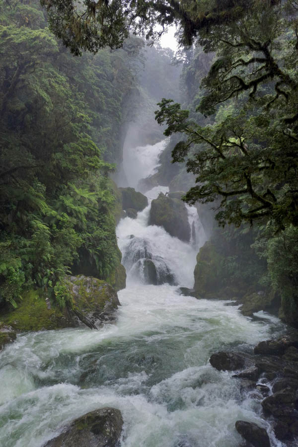
Despite the continuous rain, it was a pleasant walk to Sutherland falls and well worth the effort. This is the highest waterfall in New Zealand and in fact in Australasia at 580m high. Even on a wet day it was pretty impressive. The spray coming off the bottom of the falls was pretty impressive and soaked us far more than the rain. It made photography difficult as it saturated my camera as soon as I took it out from under my rain coat.
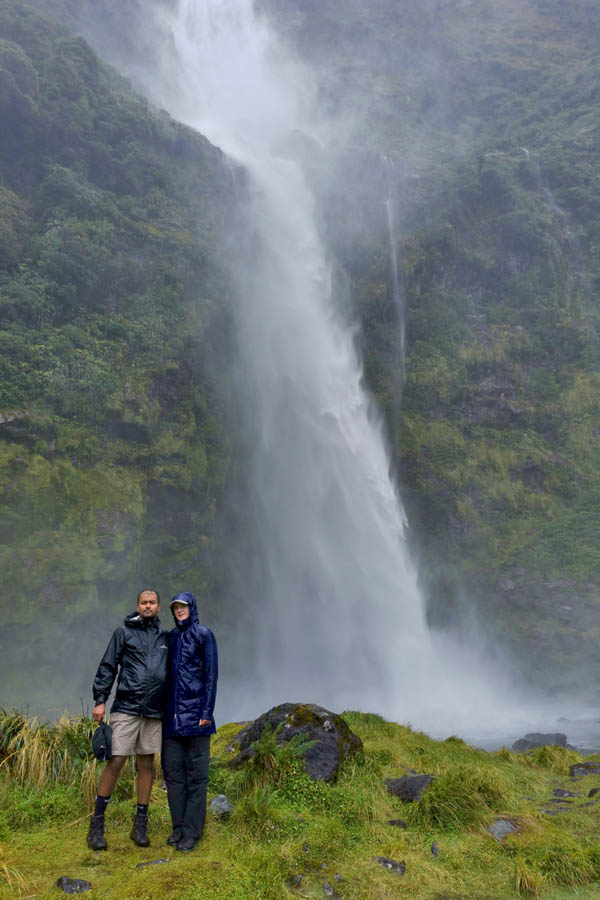
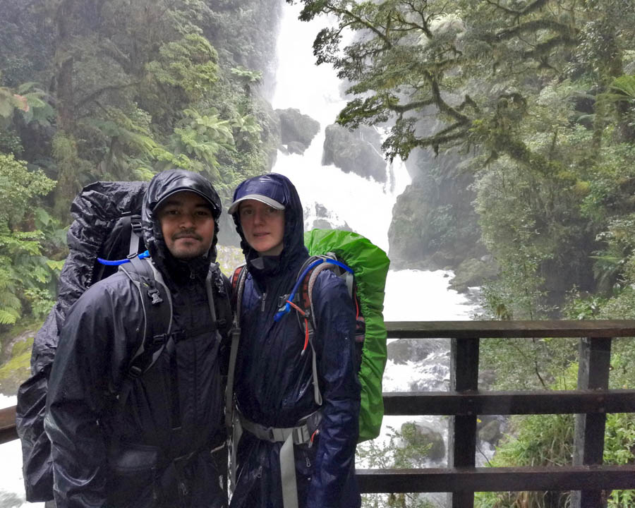
Sarah & Sach at the base of Sutherland Falls.
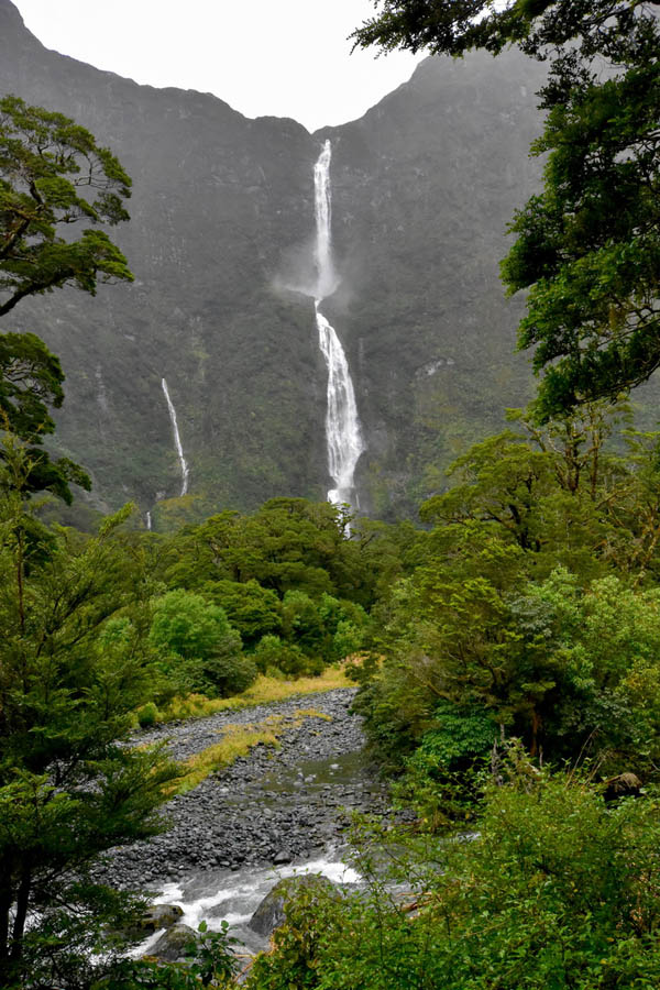
Sutherland Falls from the swing bridge over the river.
After returning to the shelter to collect our packs it was about another hours work down the Arthus Valley to Dumpling Hut.It was great to finally get to the hut and get out of our wet gear though the sand flies swarming around outside on the covered veranda made us retreat inside pretty quickly.
After sorting out our gear we headed to the kitchen to make up some hot drinks and play cards.
Despite the adverse weather we had really enjoyed the day.
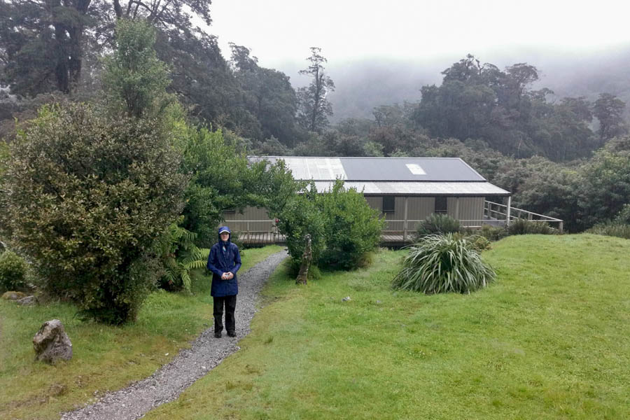
Sarah at Dumpling Hut.
Day 4,
Day 4 is an 18km walk down the Arthur valley to sandfly point you get picked up by a boat to take you to Milford Sound. We had booked a 2:00pm boat and then a cruise in Milford sound before getting the bus back to Te Anau.
We could hear the rain falling constantly through the night with some occasional heavy downpours. The morning dawned grey and wet as we headed up to the kitchen to have breakfast and collect the various items of clothing that were still hanging out to dry. We had planned to set off by 7:30 but by the time we were packed up and ready to go it was closer to 8:00. So off we headed into the rain again. From Dumpling Hut the track is pretty easy going being mostly downhill but because of the rain there were lots of small streams flowing across the track or sometimes along the track so you had to watch your footing if you wanted to keep your feet dry.Despite the low cloud and rain it was pretty amazing walking down the valley with water literally pouring off the cliffs everywhere and all the streams in flood.
Sarah on the swing bridge over the Arthur River.
Soon after crossing the Arthur river we came to MacKay falls and bell rock. Bell rock is a huge boulder that is hollow underneath. At some point in its history it would have been standing up the other way allowing water erosion to carve out a hollow and then at some point it has been tipped over so that you can now crawl under and stand up inside the hollow. The space inside isn’t that big but apparently a group of 22 Japanese trampers all manage to fit inside.
MacKay Creek below the falls.
Mackay Falls.
Sarah & Sach At MacKay Falls.
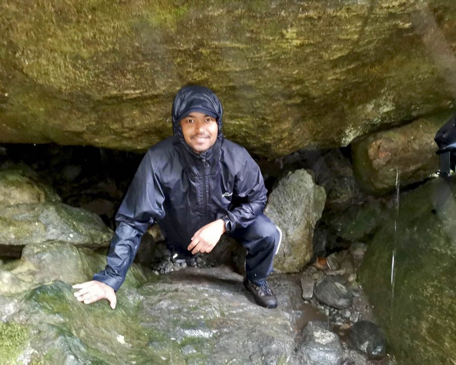
Sach Climbing Out From Under Bell Rock.
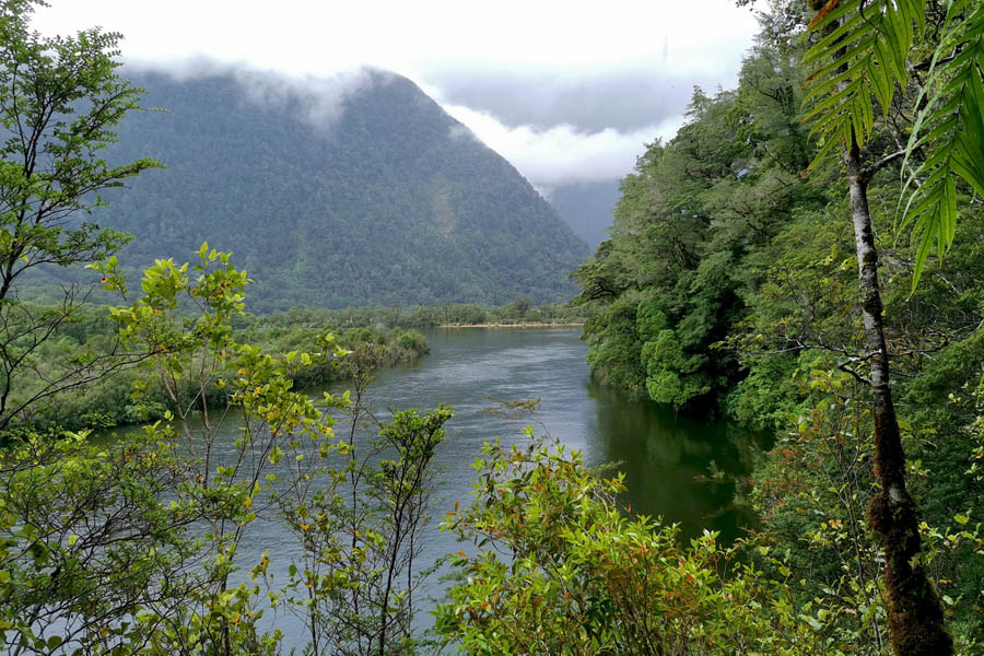
From Mackay Falls the track carries on down the Arthur valley following the Arthur valley and passing around Lake Ada through pristine beech forest and with some great views out over the river and the many waterfalls tumbling down off the cliffs.
Looking back up the Arthur River.
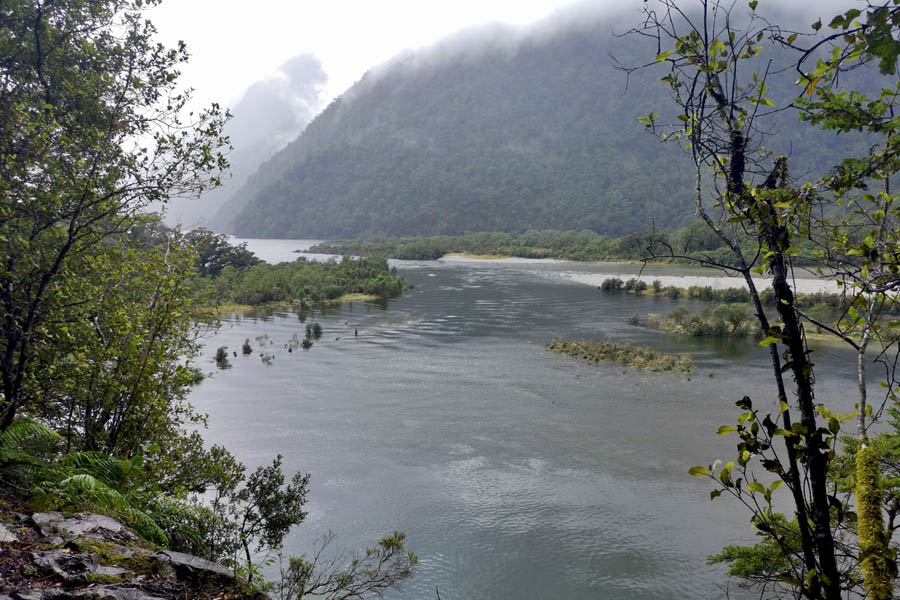
The Arthur River flowing into the head of Lake Ada.
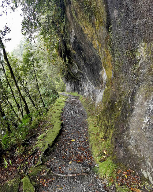
The ranger at Dumpling Hut said that this section of track is little changed from when it was first created 130 years ago.
Water Falls Pouring down into the valley.
About hallfway around Lake Ada you come to the Giant Gate Shelter where we decided to stop for lunch though the swarms of sand flies also thought that lunch was a good idea so we didn’t sit around for long. The shelter is just before the Giant gate Falls and a swing bridge over the river.
Not that much further on, just past the 32 mile marker the track widens. This is due to the efforts of prison conscript workers who were engaged to create a track suitable for a horse and buggy when some politician had the great idea of building a horse and buggy track all the way into Sutherland falls which would be pretty impossible in that terrain. After a couple of years that had built 1.8km of widened track and the project was abandoned.
The wider track past the 32mile marker.
Camp Oven Creek – More of a river than a creek.
Then suddenly, about 5 hrs after leaving Dumpling Hut, it was over. We were at sandfly point and drying ourselves off in the shelter while we waited for the boat to arrive.
Even with the two days of rain, this was a fantastic walk and a great experience.

Sarah at the end of the track.
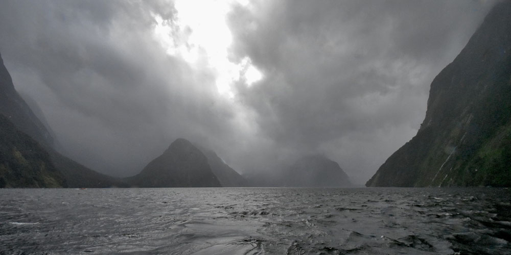
Milford Sound with Mitre Peak hidden somewhere in the cloud
Recent Posts
-

The Milford Track
For the last few years my daughter Sarah, her fiance Sach and myself have been completing a great w …13th Feb 2024 -

The Waikaremoana Great Walk
We had originally planned to walk the Waikaremoana track in Februrary 2022 but with uncertainty over …31st Jan 2023 -

The Routeburn Track
We were going to walk the Waikaremoana Track this February but had concerns that the track might not …27th Feb 2022