Pouakais Via The Puniho Rd Track
When I was a teenager tramping with my father, one of our favourite routes on the Pouakais was the track from the stony river at the end of Puniho rd that follows the ridge line above the stony river on to the southern end of the main Pouakai massive. You can then make it a circuit by descending via the Ahukawakawa track to Holly hut and returning to Puniho rd on the Bells falls track. It s a long day tramp - 9 to 10 hrs but a very rewarding tramp with great views and crossing through different sub alpine terrain and vegetation.
I had thought this track may have been abandoned but noticed recently that it had reappeared on the NZ topographical maps website (and now disappeared again) so I decided to go and investigate. It's about 40 years since I last took this route with my father.
I set off early and left my car at the end of Puniho rd at sunrise. To find the start of the track you need to follow the park boundary across the farm land and then take a short bush track down into the stony (hangatahua) river. The river was flowing quite high and had to wade up to though level to cross it.

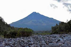
Taranaki Maunga from the stony river valley. This would turn out to be the only clear view of the mountain I had all day.
It took me half an hour to find the start of the track on the other side of the stony river as it is not well marked and my memory from 40 years ago wasn't the best. However once you get started the track is well marked and easy to follow though I did have to double back a couple of times to pick up the markers in a couple of places where it changes direction. About 20 minute in there is a side track that I assume traverses across to the Dover rd track.
The track climbs gently along the ridge through some beautiful bush before the incline increases with quite a steep climb out of the bush to emerge in the hebe layer on a steep narrow ridge. Unfortunately, the cloud had rolled in while I was climbing up through the bush. I caught a brief glimpse of the farmland below before the cloud closed in around me with only 10 to 20m visibility. The track continues quite steeply up the ridge and in the could it was one of those frustrating climbs where you keep thinking the next knob is the top of the ridge only to see the ridge stretching away above you again when you reach it.
Evetnually the hebes gave way to tussock and the track petered out to a poled trail as I reached the top of the Pouakais amongst swirling cloud at around 9:20am. The track comes up on to the 2nd highest peak of the Pouakais at the southern end of the ridge leading away from Pouakai peak. The cloud was swirling around giving occasional glimpses of the top of the Pouakais.

Looking north towards Pouakai peak which is out of sight in the cloud. The poled routed traverses around the side of the minor peaks on the ridge and joins the Pouakai track around where the ridge disappears into the cloud.

Looking across to Tatangi peak

There were plenty of these alpine flowers in the tussock.
I carried along the ridge to join the Pouakai track and followed this track to the intersection wit the the Ahukawakawa track where I emerged below the cloud and gained intermiittent views across the swamp (Ahukawakawa) .

Ahukawakawa from the top of the Ahukawakawa track. Henry peak is just out of the picture to the left.
On a fine days you get great views of the Taranaki as you descend on the Ahukawakawa track but not today with the mountain remaining hidden in cloud. The track passes through patches of mountain cedar (pahautea).

Mountain Cedar (Pahautea)
Despite the cloud I had some good views out over Ahukawkawa

Looking out over Ahukawakawa with the track tunneling through a patch of bush and the boardwalk snaking out over the swamp. Holly hut can be seen just under the cloud to the left of the Dome.

The head waters of the stony river (Hangatahua) flowing through the great swamp Ahukawakawa.
It's a couple of years since I've been on the Ahukawakawa track and the first time since the new board walk has been installed making it an easy stroll from the bridge across the river most of the way to Holly Hut whic I reached at 11:30am. I then headed down to Bells falls I stopped for a quick bite to eat.

The view from the Bells Falls track as it traverses around the side of the dome - looking down the Stony River valley towards the farmland and coast.

Bells falls
From bells falls the track follows the left side of the river valley crossing numerous small streams and is rough in places as it winds through river boulders on the side of the valley then climbs up in to the bush until rejoining the stony river valley at the junction with the Pyramid stream.

Came Across this fascinating fungus beside the track.

Looking back up the Stony river valley towards the Dome.
From the Pyramid stream the route carrys on down the river valley with two options to return to Puniho rd either via the Kapoaiaia track or carrying on further down the stony river valley to join the Puniho track. I chose the latter route which continues on down the stony river for another 40 minutes or so. There were a couple of places where the stony river has cut back in agains tthe left hand side of the valley but there was always enough room to carry on down the left hand bank without the needing to cross the river. There is one section that is now a relatively narrow channel which I assume is a result of slips in the last few years as the river valley was always mostly wide open in the past on this section of the river.

The Stony or Hangatahua River - in the narrow section of the river channel.
Soon after I rejoined the Puniho track I cam across a couple of tomtit which hung around long enough for me to get my camera out of my pack.


Male Tomtit or Miromiro.
I eventually got back to the car at the end of Puniho rd at 3:00pm feeling pretty tired but vary satisfied after a long and rewarding tramp - despite the cloud.
Recent Posts
-
The Milford Track
For the last few years my daughter Sarah, her fiance Sach and myself have been completing a great w …13th Feb 2024 -
The Waikaremoana Great Walk
We had originally planned to walk the Waikaremoana track in Februrary 2022 but with uncertainty over …31st Jan 2023 -
The Routeburn Track
We were going to walk the Waikaremoana Track this February but had concerns that the track might not …27th Feb 2022


